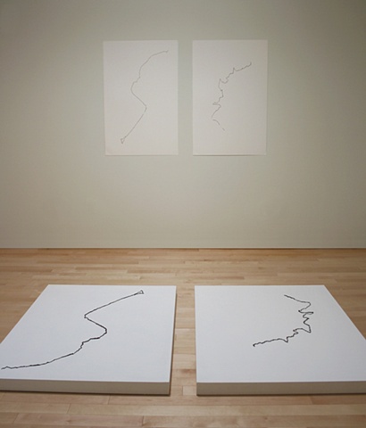
Ebb N 45° 49.706. W 064° 34.952
Flood N 45° 49.706. W 064° 34.952
Flood N 45° 49.706. W 064° 34.952
2009
Mud from the ocean floor, Platform, Paper
The coordinates named locate Hopewell Rocks, New Brunswick, an area with unique geological features where the tide can rise over fifty feet in six hours making it possible to walk on the ocean floor at low tide. This project used a GPS to map the shoreline there. At low tide, the contour followed the water line as close as possible. A second line was recorded along the cliffs as the last bit of traversable land became flooded. The intricacies of the recorded shorelines were translated into simple linear reliefs on two floor platforms as well as two pieces of paper hanging on the wall using mud from the site. The mapping of both the linear traversal of the land and the temporal rise of the tide integrates the unfolding of time and space. The installation positions the viewer in the gap between the surfaces and shores.